Computer visualization can play an important role in educating the public about the storm surge hazard. More than 85% of the current coastal population has never experienced a direct hit by a hurricane. Relatively few people have much appreciation of the drowning potential of a large storm surge. During Hurricane Hugo in 1989, the surge reached 20 feet in McClellanville, a sparsely populated area just north of Charleston, South Carolina.
Historically many people have chosen to ignore evacuation notices even when living on low-lying areas, such as the Florida Keys. For example, nearly half the residents remained in Key West during Hurricane Georges in 1998, which could have resulted in thousands of deaths from drowning if this category 3 hurricane had not veered 90 miles to the west and lost strength. Apparently many people do not relate the 2-dimensional maps of the evacuation zones to their 3-dimensional life xperiences. Real-time, 3-D computer animations of storm surges during hurricane landfall can capture people’s attention and reverse complacency of a TV-focused population when evacuation orders are given. People need to understand the serious threat of living in flood-prone areas and the storm surge potential during major hurricane landfalls. To reach more people in an educational and informative format, the IHRC is developing a 3-D visualization system to animate numerical calculations from storm surge models.
A streamlined methodology for new tools, techniques and visualization strategies is being developed. This system provides visual display of key impact areas. Computer animations allow users and stakeholders to visualize the surge of water moving inland and flooding a city.
Our team has formulated various automated algorithms to extract features from airborne LIDAR data. These tools allow the user to separate the built environment from trees and to extract the footprints of buildings, apply a height, and then reinstitute the buildings back into a highly accurate topographic map (e.g., digital elevation maps).
The complete visualization involves interaction between the storm surge and the virtual environment. A clip of the achieved animation is included on the CD enclosed (see back pocket).
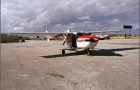
Digital images acquired from ground-level and aerial photography provide the real-life skins which are superimposed on wire-mesh elevations of buildings and other features obtained from airborne LIDAR to produce the virtual environment (see below). Real-time animation in a forecast mode also requires the storm surge model to run extremely fast; therefore, we are utilizing a Beowolf cluster to enhance computing performance.
 |
+ |  |
= |  |
| Digital Photos (Skin) | LIDAR Data (Skeleton) | Animated Buildings (Virtual) |
In a real-time operating mode, we will generate computer animations illustrating low and high flooding scenarios utilizing the National Hurricane Center’s “cone of strike probability” and storm intensity. IHRC researchers will work with emergency managers to identify the key areas to be visualized, including familiar community landmarks and critical evacuation routes. Additional funding will allow full development and real-time implementation of this technology.

Storm Surge Animation for South Beach, Florida (see CD)
Click the following link to download the movie clip for South Beach Storm Surge Flooding
South Beach Storm Surge Flooding (wmv format, 59 MB)